Cape May As I Remember It: Part Three
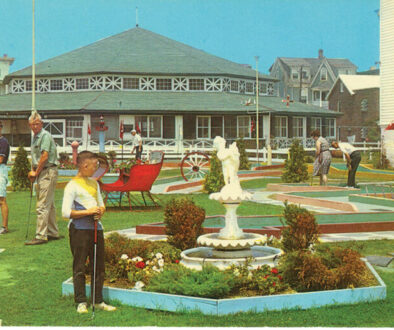
East Cape May to me is all of the land from Madison Avenue to the U.S. Coast Guard Training Center. On Beach Avenue, where the Capri and Ocean Club are currently located, was a carousel and the Cape May Playhouse. I don’t remember the carousel, but I do remember the playhouse. Some of the notables who performed there were Edward Arnold, T.C. Upham, Ronald Reagan, Mickey Rooney, John Carradine, Gloria Swanson, and I’m sure many others. In the same block is the Kiwanis Clubhouse. This was previously a Coast Guard lifeboat station that the Kiwanis purchased for the sum of $120 in the 1930s. The Peter Shields Inn was known as the Cape May Tuna Club at one time.
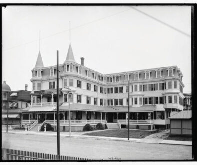
As we know, the Christian Admiral was demolished several years back and it is still fondly remembered. It was a grand hotel with marble floors and columns in the foyer. During World War I it was used as a hospital, and in World War II it was used as officers’ quarters for the military. Behind the hotel on New Jersey Avenue were a garage and living quarters for the help.

Along Beach Avenue there were trolley tracks leading to a former amusement park at Sewell’s Point, which was located close to the Cold Spring inlet jetty. The park was destroyed by a fire. The pilings which supported the trolley tracks were quite visible at Poverty Beach for many years. The storm of 1962 exposed much of the remaining pilings along the entire beachfront. All that is left is memories.
New Jersey Avenue was a dirt road from Madison to Yale Avenues. The city had a water truck that rode up and down New Jersey Avenue spreading water to keep the dust down. At the end of Maryland Avenue is the Cape May Beach Club. There was another clubhouse before the one that is there now that was destroyed by fire. The closest fire hydrant nearest the Beach Club at that time was on the corner of New Jersey and Wilmington Avenues. Hose line had to be dragged from New Jersey to Maryland Avenue, and then two blocks along to the clubhouse. It was one of the darkest nights I can remember, very still and quiet except for the sounds of the wood burning on the structure. It was a nice building and I’m sorry it was lost.
In the first two blocks on New York Avenue nearest Madison Avenue, there is a row of houses that were identical in shape when constructed. They were called “birdcage row” because of their square shape. They are still there today, but some of them have been modified. I recently saw a Coastline Realty ad which showed these homes were sold by Sears, Roebuck and Company for less than $1,000. This price did not include shipping and construction.
Maryland Avenue was only paved to 1023. From 1023 Maryland Avenue to Pittsburgh Avenue was undeveloped. All the remaining streets from Idaho to Massachusetts Avenues were paper streets. This area was not up to grade, and flooded after a heavy rain. When this area froze in the winter, many kids used to ice skate or sled on the ice. It was the closest thing we had to a pond.
The east side of Pittsburgh Avenue was all “fill,” as we called it. There were large summer homes on New Jersey and Beach Avenues that are still there today. They were the only homes in this area back then. Navy Base #9 was there, now the Coast Guard base. Pennsylvania and Delaware Avenues were not there, and the only entrance to the base was Yale Avenue, which ran from New Jersey Avenue along the cyclone fence to the same entrance that is there today. After December 7, 1941, Pennsylvania and Delaware Avenues were constructed from Pittsburgh Avenue to the base entrance, along with 50 housing units. These houses were eventually sold and replaced by what is there today.
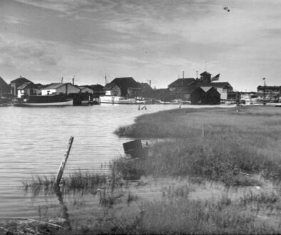
Harbor Lane was a dirt path that led to Devil’s Reach. Poison ivy lined both sides of the path and you had to walk in the center or else. There was a small beach at Devil’s Reach, good for swimming, especially at low tide. In this same area—and all along the harbor—were soda bottles that washed ashore. We used to collect them and take them to Zimmerman’s store. He gave us two cents for the small bottles and a nickel for the large ones. We never took the money, but instead bought soda or candy.
Last but not least, east of Pittsburgh Avenue is the Coast Guard base. In the 1930s it was a US Naval base called Base #9. There was a large hangar, similar to what is in Lakehurst today. I never saw a blimp there. I guess the government didn’t want the hangar, as it was eventually demolished in the 1940s. There were two Navy seaplane hangars on the harbor, and we were able to see seaplanes take off and land. Closer to the ocean was a runway for the planes. A portion of it is still there today. The Navy used the Atlantic Ocean beaches for dive bombing and machine gun practice, using two-pound bombs and 30 caliber bullets. On the days after bombing practice a number of us would go to the beach and pick up many spent 30 caliber machine gun shells. We had enough sense not to pick up any live two-pound bombs for obvious reasons. You couldn’t do any of this today. In the 1950s the Navy turned the base over to the Coast Guard. Speaking for the citizens of Cape May, Lower Township, and other area communities. We do appreciate the “coasties.”


